


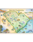
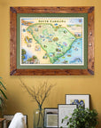
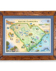
South Carolina State Hand-Drawn Map
$30.00
Celebrate the coastal beauty, rich history, and diverse landscapes of South Carolina with this 24" × 18" hand-drawn lithographic map by Xplorer Maps. Created in pen and ink with watercolor by Xplorer Maps Co-Founder Chris Robitaille, this original illustration showcases Charleston's historic architecture, Hilton Head Island, Beaufort, Myrtle Beach, Columbia, Greenville, Caesars Head State Park, the ACE Basin, scenic rivers, wildlife, marshes, and the Atlantic coastline.
Every illustration captures the places, wildlife, and landscapes that make South Carolina a favorite destination for beachgoers, outdoor enthusiasts, and history lovers alike. Whether displayed in a home, beach cottage, office, or vacation retreat, this fine art print is a timeless keepsake celebrating the Palmetto State.
Product Details
- Dimensions: 24" × 18"
- Orientation: Horizontal
- Fine art lithographic print
- Original artwork by Chris Robitaille
- Ships rolled in a protective tube
SEE THE SPACES SHOWCASING THIS PRODUCT


Disclaimer: When you shop from this page, From Where and the property may earn a commission. Clicking a product link means you agree to our Terms of Use and Privacy Policy.
